A week in Musandam (full itinerary with coordinates and map)
Musandam governorate is located on the Musandam peninsula, separated from the rest of Oman by the UAE. Its location gives Oman partial control, shared with Iran, of the strategic Strait of Hormuz, the narrow entry into the Persian Gulf from the Arabian Peninsula. From Muscat, you can fly, take the ferry from Shinas or drive through UAE: either way, it's a bit complicated to reach this unique corner of Oman. The ferry only operates on certain days, and getting a car ticket is nearly impossible, and it leaves from Shinas, around a 3-hour drive from Muscat. Driving from Muscat to Musandam requires crossing borders twice, which can take anything from 30 minutes to many hours. Flying means you will need to rent a car, and if you want to visit anything beyond the capital, you will need a 4WD. In short, it's a bit of a hassle to get there, but after spending a whole week there, I can confidently say it's worth it!
Day 1: Muscat - Drive to Khasab; stay in Atana Musandam.
Day 2: Discovering the Khasab area: Khor Najd, Acacia forest, Qadah rock carving, Harf Plateau; stay in Atana Musandam.
Day 3: Boat trip to Kumzar; stay in Atana Musandam.
Day 4: Off-roading and camping in Musandam mountains; camping
Sayh village with terraces, walk to the UAE/Oman border, pass Jabal As Sayh (or Jabal Harim), and drive on the crazy ridge road.
Day 5: Off-roading and camping in Musandam mountains; camping
Lock house, petroglyphs, a remote village close to the Diba border, Limah.
Day 6: Boat trip to the two seas meeting point; stay in Atana Khasab
Day 7: Khasab fort, drive home
Day 1: Muscat - Khasab drive
The drive was long and tedious, and it took us over 3 hours to cross the two borders. But it was all forgotten when we were driving along the coastline road in Musandam! The sea indeed rules: the remains of the old road are visible here and there; it seems it got washed away. Our timing was perfect to enjoy a stunning sunset from a parking lot.
Day 2: Discovering the Khasab area
Day 3: Boat trip to Kumzar
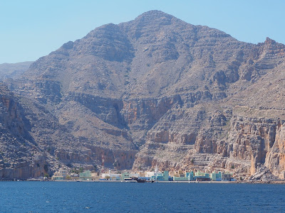
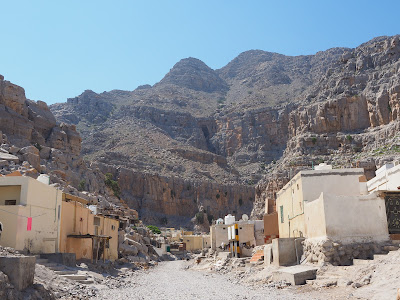
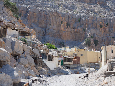
Kumzar is a very remote settlement and only accessible by boat, and we heard of plans to build a road to connect it to Khasab. For now, it's like a time capsule: little changed here, goats are roaming the "streets", where the main street is a wadi, and local ladies are wearing metal face masks. It took more than 2 hours to reach it from Khasab port. Unfortunately, we didn't have time to hike as the sea got choppy, and the captain started worrying. We booked the trip with Dana Khasab Cruises and were happy with them.
Day 4-5: Off-roading and camping in the Musandam mountains
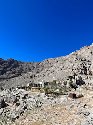
We followed route 3 (Musandam Mountains) from the Oman off-road book. Once you leave the asphalt road (26.0906,56.2577) soon, a steep ascent starts on a winding dirt road and beautiful views. The road is well-maintained and wide. Our first stop was at Sayh village, surrounded by green terraces (25.9863,56.2095), where we walked to the Oman/UAE border - a nice and easy short walk with stunning views. Next, we continued towards Jabal Harim, the highest mountain in Musandam: unfortunately, it's off-limits due to a military base, so we were hunting for petroglyphs (25.95751, 56.21916). Finally, as we crossed the mountain towards Rowdah Bowl, our breath was taken away: the road running atop the ridge was just stunning. If you have time for only one off-road trip, pick this one! We camped overlooking the bowl (25.9048, 56.226).
The next day we descended to the valley and drove towards the Dibba border cross, which locals can only use. This is where we found a beautiful stone lock house or bait al qufl (25.862, 56.2271): these were used to lock up valuable possessions while the family moved to the coast during the winter months. Not far from it, there is an old cemetery worth checking out. Another 4-5km down the road, there is a large petroglyph site, the best we have seen in Oman (25.8319, 56.208). Our next stop was Limah, this secluded beach town that was only accessible by boat up until recently: now, there is a scenic dirt road connecting Rawdah to Limah. I wish we had time to camp, as Limah looked beautiful - the beach, the coastline, and the abandoned village on the hillside above Limah Port all seemed very interesting. But as we were running out of time and there was a risk of rain, we turned back and drove back to the bowl.
As we approached our night camp spot (25.96384, 56.20505), we noticed a strange rock wall (25.9652, 56.2262): later, in Khasab Fort, we learned that these are fossilized crab burrows and over 250 million years old! We also found beautiful fossils around our campsite.
Day 6: Boat trip to the two seas meeting point
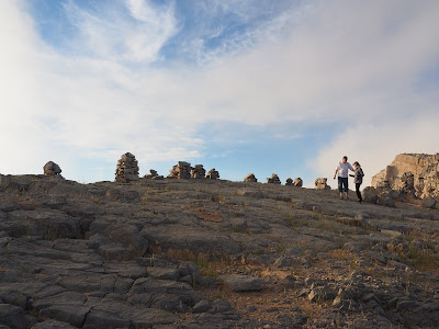
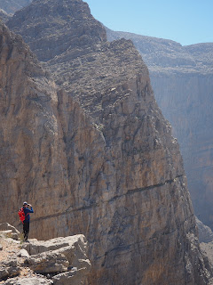
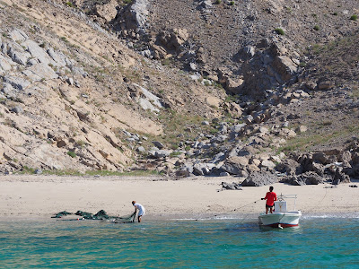
Our second boat trip was shorter as we headed to the fjords this time. We sailed to the narrow peninsula separating the Arabian Gulf and the Oman Sea: the captain parked the boat just next to the cliff, and we jumped off and took the stairs leading up to a viewing platform. Make sure that you explore the area beyond the platform: there is an old village ruin, and views progressively get better as you climb higher. We also stopped at Telegraph Island: we would have snorkeled if the sea was not choppy and the weather less windy.
Day 7: Khasab Fort and drive home
On our last morning, we explored Khasab Fort, and it was such a treat. So often, forts in Oman are over-renovated (they look like new builds) and provide little background information. This one has an excellent exhibition about the history of Musandam and the fossils you can find everywhere.











Comments
Post a Comment