Omani nature at its best with easy access - hiking in Wadi Bani Kharus & Hijayr
If you are searching for an easily accessible wadi where you can still experience what Omani nature can offer at its best - Wadi Bani Kharus is your place! It is just the perfect weekend gateway from Muscat and here is why:
✅ You can reach it under 2 hours from Muscat.✅ There is no need for 4wd! The wadi has great road network, perfectly suitable for saloon/sedan cars.
✅ You can still find great off-road routes!
✅ There are tons of fantastic hiking options from shorter to long and technical hikes - you can hike to Jabal Akhdar from here !
✅ It offers a fun falaj hiking,
✅ or you can hike through the wadi bed and immerse into one of the pools,
✅ or hike to a fortified abandoned village built on a dramatic cliff top!
✅ You can find wonderful and picturesque villages and stroll through lush plantations.
✅ Bonus point you can get a glimpse into traditional Yemeni-style architecture!
The only downside - if you can call that - is the lack of accommodation (at least we did not find or see any). You have to camp if you want to stay overnight.
There is a great overview of the wadi in the Oman-offroad book (in our edition with Sugar Dunes and a camel on the cover it is route 19) and they mention some of the hikes although as usual the hike descriptions are not too great so I will focus on those here.
There are 2 wadis to explore here, Wadi Bani Kharus and Wadi Al Hijayr which share a common entrance at Al Awabi. Kharus is the bigger and more populated - the villages are almost growing into eachother. According to the Oman off-road book there are 4000 people living in Wadi Bani Kharus and only 500 in Wadi Al Hijayr. Both wadis are home to great hiking trails and in Wadi Bani Kharus the villages are surrounded with lush green plantations and water is flowing all year around.
Once we can have visitors, this will be for sure on the list to show them!

Here are the different hiking options, scroll down for the details!
1. As Suwayah - the falaj hike (23.2042,57.5124)
2. As Suwayah - the fortified abandoned village (23.2042,57.5124)
3. Trail heads in Thaqb - long distance trail (23.1732,57.4871)
4. From Al Alya to Ad Dar and beyond (23.1814,57.6545)
5. Safah or Soldiers Bridge path (23.1772,57.6500)
1. As Suwayah - the falaj hike (23.2042,57.5124)
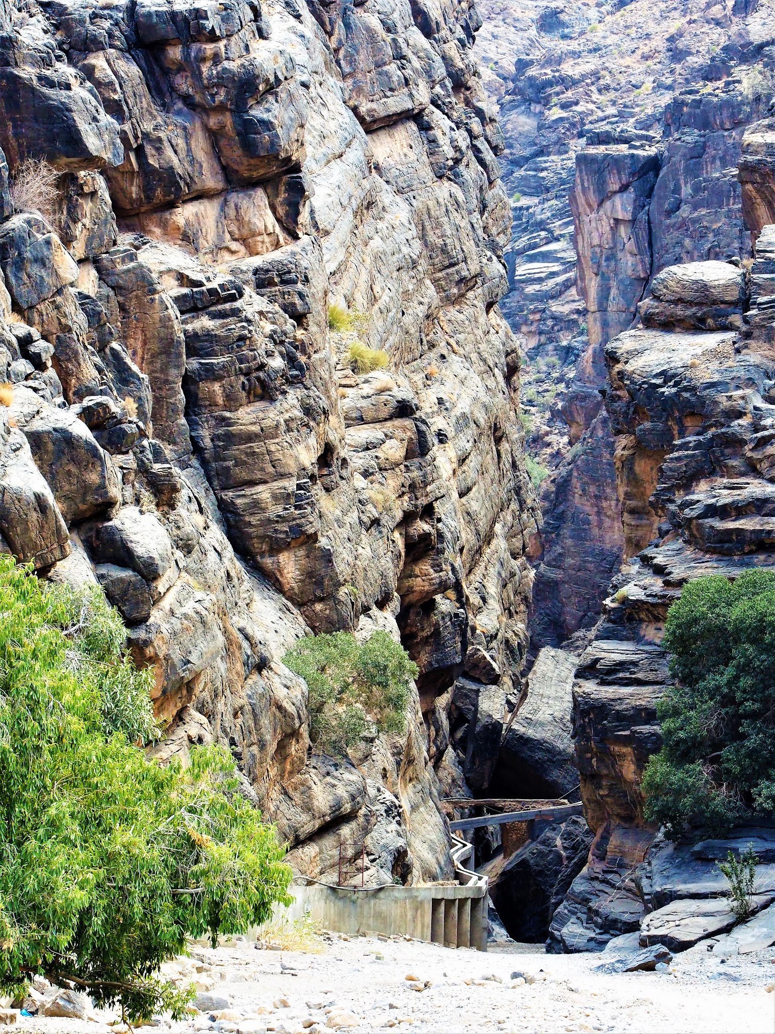
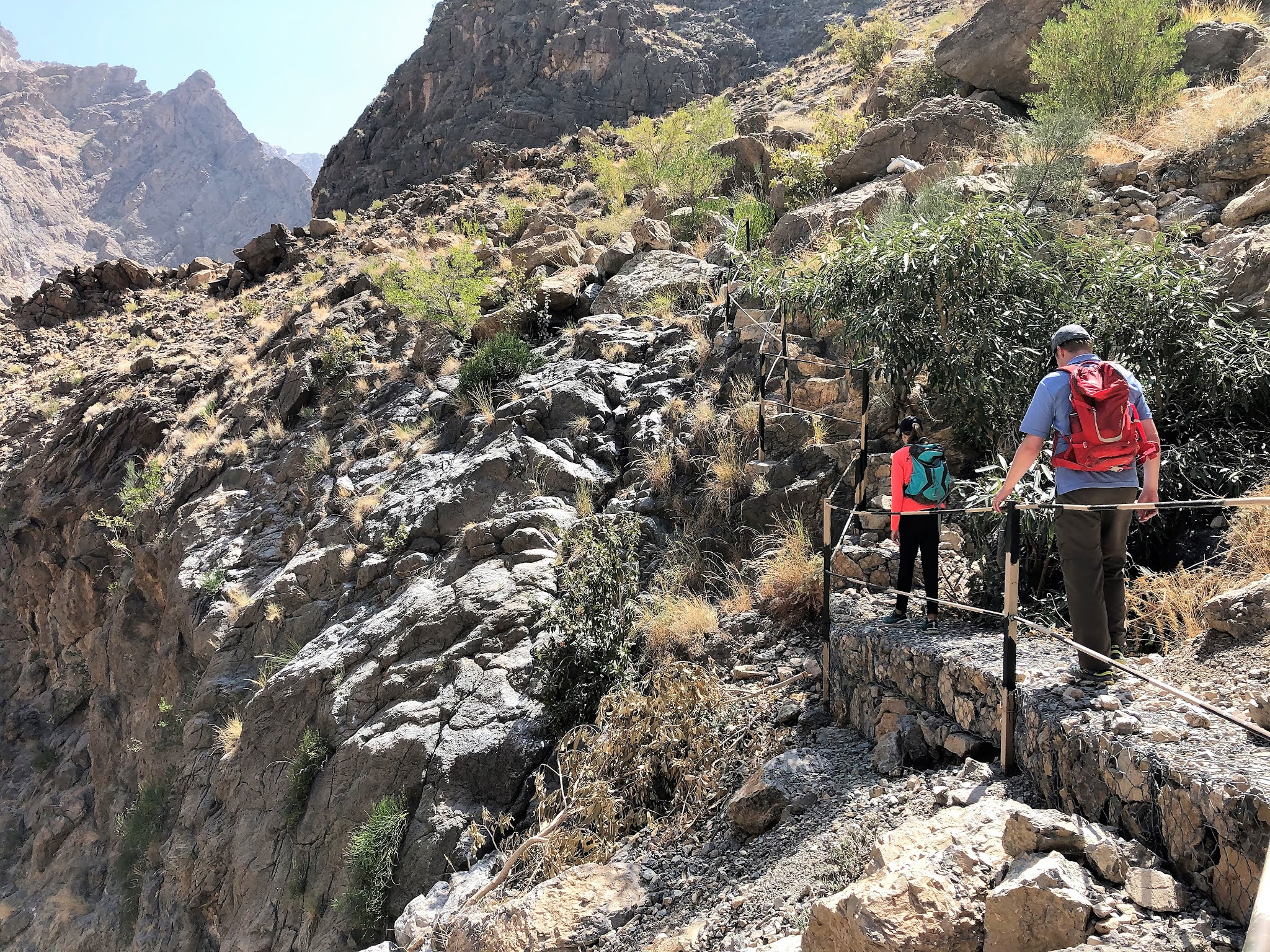
This village is adjacent to Al Hijayr, the main town of the wadi. There are only couple of houses, some of them are quite old. When you arrive you will note the modern cement falaj running into the wadi - difficult to miss. Once you reach the wadi entrance, do not miss to explore the small cave with modern "cave-paintings" :). You can also see the old arch built from the old falaj if you look carefully - pretty amazing what they could build back then. Once had enough fun in the cave, go back the entrance and take the steps to the right. Once the steps run out, descend to the wadi bed - the first section of the falaj is too high up to walk on it (well, for my taste at least). Once you see the falaj dropping to wadi level you can climb up and simply follow it as it snakes through the wadi with HUGE boulders. As usually, towards the end the boulders get bigger and bigger but you can always find a way - we found some makeshift ladder built of branches to help us through the worse part. And voila, you are at the water source, a cave with a waterfall - although the waterfall not really visible unless you climb into the pool which we did not. But you can hear it and maybe when there is more water, you can see it as well. As per the Oman offroad book there is a smaller wadi branching off just before the cave with an even bigger waterfall, but we did not see any track only huge boulders so we skipped it.
It took roughly 1 hour to reach the cave and little less to come back. Overall it is an easy hike - you mostly walk in the shade.


2. As Suwayah - the fortified abandoned village (23.2042,57.5124)
This is a super interesting one - we were very positively surprised! You have to duck under the falaj and walk by the old stone house ruins on your left. You will see a small canyon in front of you - it really looks like the miniature version of Snake Canyon (no water though)! You can follow that but be prepared that at the end you either have to climb up a steep and slippery "chimney" or you need to walk back and take the path up to the hillside. We took the path - it is faded but there. Once you feel you reached the end of the road with big dark slabs on your right just climb those slabs and you will pick up the path once you are higher up. Keep walking until you see a hollowed out area consisting of thin lawyers of shale - great spot to stop and enjoy the shade and this is also where you have to turn right and take the even more faded path uphill. After a few min you will see the remains of the village.. it is pretty stunning, this was one of the rare moments I wished we had a drone! From here you can see the path on your left leading to the village, it is worth to explore. Unfortunately what left is really some piles of rock but it is still mind blowing how they built it here and why and how they got water etc.. Would be interesting to know more about the history. The village is roughly located here.
The view of Al Hijayr and road leading to Wadi Bani Awf in the distance

This is where you just start walking up on the slabs until you see the path again on your left!

The village - it takes a few sec to realize what you see!

Al Hijayr from the abandoned village

The view from the village was just incredible, to all direction.


Thaqb, this small village of few houses at the end of the road is home of few long distance trail heads. They do not seem to be marked and we did not see any info board or sign in the village either. There are detailed descriptions in the Adventure Trekking Oman book but they are anywhere between 6-10 hours in one directions or require overnight camping. Of course it is always possible to walk some of the path and turn back - maybe an other time!
4. From Al Alya to Ad Dar and beyond (23.1814,57.6545)
Al Alya (or Al Ulyah as it is called in Google Maps) is an absolutely stunning village with plantations and lush green terraces in Wadi Bani Kharus - this is the last village on the road to the wadi. Just to walk around the plantations and terraces is a great experience (for that it is better to park at 23.1802,57.6489) - there is a nice falaj to follow as well. In the wadi bed there are pools and we saw people swimming in them - we however headed to Ad Dar village. It is possible to start the walk from both parking - the second will lead through the gardens, the first will give a nice view of the village. The path is marked, you just need to follow the usual tricolor flags. Once you cross the wadi bed and climb up the other side you will see a small hamlet with a few houses and terraces - that is Ad Dar. You can walk down to the village and continue in the wadi bed to find more pools deeper in the wadi - you can read about that hike here. This time we continued to follow the tricolor flags and climbed high up in Wadi Bani Kharus - we climbed to 1500m and the views were incredible! This route eventually leads to Sayq Plateau.
The oasis of Al Alya (or Al Ulyah)

Can you see the people around the pool?


Ad Dar

We continued to climb up towards Sayq Plateu and turned around when we reached 1500m altitude - it was steep climb but the view was stunning!


Short stop at the shade - although the sun was burning, the breeze was nice and cool.


This path leads to Jabal Akhdar and the whole trek is 12km - this path and the one described under previous point eventualy meet at Safah or (Saqrah) village, where The Cliff Gueshouse is nowadays. There is a viewpoint with flag pole and it is 2.5km roundtrip - relatively short, although some comments suggest that it is a steep climb.


Comments
Post a Comment