We spent the Halloween weekend in Jebel Shams, the highest mountain in all of GCC - the summit is at 3007m! The name, Jebel Shams means the "Sun Mountain" - and it is quite accurate name as the peaks are beautifully lit. Now we can say we have seen Jebel Shams from all direction - few weeks ago our camping spot in Wadi Shatan had a beautiful view off the peak just from the other side. This is also the home of a 1km deep gorge, Wadi Ghul or the Grand Canyon of Arabia - it certainly makes you dizzy looking down from the edge but this did not stop us from camping there though. The view was superb, camping not that great - it is a very popular spot as it is relatively easy to drive to, some people even made it with a salon car. We had a young group of Omani men partying whole night next to us.. not so great.
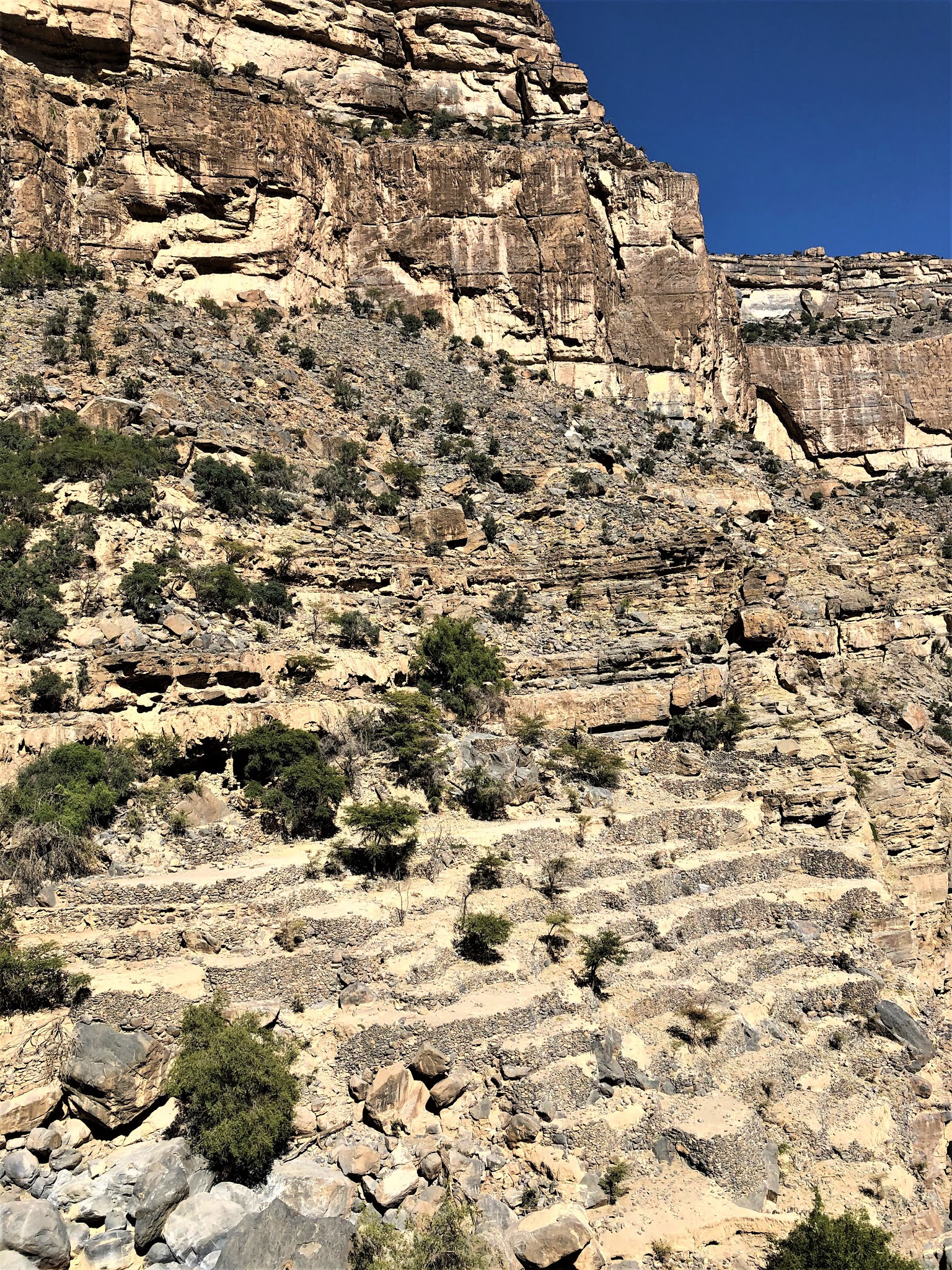
First day we did the Balcony walk - an 11km trek close to the rim of the canyon leading to the abandoned village of As Sab (or Sab Bani Khamis - everything has multiple names here..) - it is pretty amazing that people lived in such a remote location and cultivated terraces etc. But with steady water supply it must had been a safe and protected area back in the days.
The second day we actually drove to the wadi - An Nakhur village is tucked 7km deep into the wadi and a very bumpy road lined with huge boulders leads there. We also had to cross some water pools! Unfortunately Alma and Finn did not feel like more walking so we did not discover the wadi beyond the village - maybe next time.
Location for parking for Balcony walk: 23.1937,57.2017. Easy, marked hike, round trip takes 4-5 hours
Location for Wadi Ghul starting point: 23.1469,5720. After rain check the road situation of the road, you can text the guest house inside the wadi (they are marked in Google maps.)
Can you spot Finn and Alma?

First night we stayed in Sama Heights Resort as we arrived quite late - the food was average but the room and view was very nice. The reception looked quite magical at night - although during day time it was a little "sad" as Alma put it!

Chandelier made of traditional Omani pottery
The Balcony (or Rim) walk offers spectacular views of Wadi Ghul. The view point is easily accessible, next to the road and if you watch carefully you can see the village and the lake above the arch - that is where we were heading! We were here in 2016 but we left too late and we turned around before reaching the village.
The trail for once is well marked - but of course it is also very difficult to get lost here :).
The bottom of the canyon - our destination for the next day.
The houses of As Saab are hanging on the side of the mountain and they are spread around in a surprisingly big area - apparently once upon a time they sheltered 15 families.
It is truly fascinating to see that they were able to build this extensive terrace system in such a rugged terrain. And even though the terraces have been abandoned for long time, they are still quite intact.
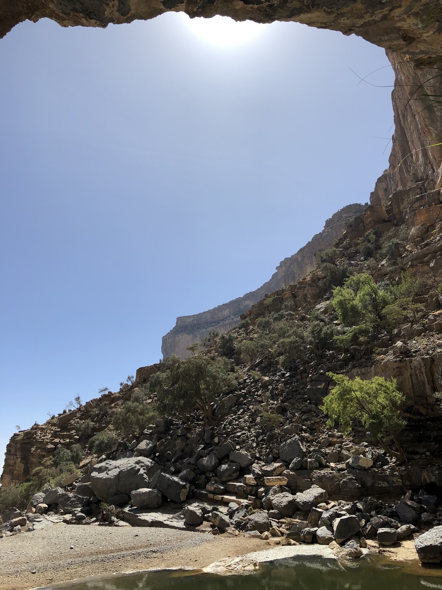
It was little tricky to find the lake above the village but finally we managed - the cave behind the lake has fresh drinking water and is super cool so we had a nice break here. The water seemed too dark and full of plants so we skipped swimming this time.
Our busy camping spot for the night
Above Finn's head is the military base at 3007m
This is where we are heading - at the bottom you can spot a small village.
But before we headed to the bottom of the canyon, we drove to the most remote part of Jebel Shams to see a Juniper tree "forest"
Even here, few hours drive from any main road and civilization, they built an impressive school - must be the school with the best views.
Juniper trees - we should had camped here, certainly was not crowded!
Wadi Ghul, An Nakhur, the bottom of The Grand Canyon of Arabia. The entrance is through the wadi bed, in between of old (left) and new Ghul. Ghul means something like bad ghost, not sure why they picked this name..
The vertical cliff walls were impressive and at times the path got super narrow and wet - we had to forge some deeper pools as well.
There are couple of families living in this remote location, farming like they did decades or even maybe centuries ago. After heavy rains the road is washed away and they are cut off for weeks, until the road is repaired.
The village is surrounded by plantation and it a mixture of renovated houses with satellite dishes and mud brick house ruins.


Will visit this place for sure in coming weeks InshaaAllah. Thanks for the details.
ReplyDeleteIt is an easy hike, absolutely worth it. Heard that it is marked now all the way to the lake !
Delete