This was our first camping weekend, and we have to declare it as an absolute success. We managed to put together the right gear and we had a great weekend. Camping in Oman is easy and at the same time not. It is easy as you can basically camp everywhere but difficult as there are no facilities meaning you have to bring everything with you: food, water and even your toilet. Which means even a 2-night trip meant the car was full. We bought the majority of the gear from a family who left Oman but still needed to hunt for a few items - we were busy with this whole week!
We decided to go to Wadi as Sahtan: we drove Thursday night to Wadi Bani Awf and found a spot there for the first night. We usually follow the advice of the Oman off-road book but the campsite marked in the book was not there anymore which meant we had to improvise. We were short of time as it gets dark early here (shortly after 6pm) and we just picked something off the road - it worked out fine with the exception of the dog starting to bark like crazy at 5am. We had never seen a stray dog in Oman and of course our first one had to be on our fist camp night - classic.
Second day we drove to Wadi as Sahtan which is basically a huge bowl with mountains around, plenty of villages nestled and tucked away and the magnificent Jabal Shams as a backdrop. We visited one of the most remote ones, Yaseb: the 10 km road to the village took 1.5 hours and offered amazing views of the "bowl". It is also a challenging and steep drive, but Finn and our car did a fantastic job!!
Our camping spot this time was perfect: with undisturbed views of Jabal Shams, the highest mountain in Oman with bit over 3000m. The rising sun set the mountain on fire, and we got a full display why it is called the "Mountain of the Sun".
On our last day we explored two more villages: Madruj and Wajmah. Madruj was just above our camping spot while Wajmah required some more thrilling driving, but the reward was amazing: the village practically invisible until the last turn (a hairpin one of many) and clings on the side of the rock. Only consists of a couple of houses and most of them abandoned or only visited by the owners occasionally - just one family lives there permanently. It offers a small oasis and has a water source - when it rains it even has a small waterfall. We hiked a little to discover the surrounding of the village - we met an Omani family (a man with 3 small kids) who offered to show a pool and viewpoint above the village. We set to follow them, but it was just too crazy - one of his kids slipped and pushed some rocks, the man managed to catch him, but this was the point when we turned around.
At the end of the post, you can find a map with coordinates for the most important sites and turning points for the trip.

The first few kilometers of Wadi Bani Awf is paved but gives a good glimpse of what to expect. Location: 23.3421,57.4932
Our very first camping spot in Oman, Wadi Bani Awf.
Location: somewhere around 23.2376,57.4334
The drive from Wadi Bani Awf to Wadi as Sahtan is easy - the "door" between the two wadis is marked with an impressive rock gap. Location for turning to Wadi As Sahtan: 23.2577,57.4409
Where is the road?
Here it is!
Either a young lady or a grumpy old man.. you decide!
Wadi Sahtan with Jabal Shams in the background
The road to Yaseb is a 10km long hard-core off-road dive. The off-road book and many blogs warn about it but actually it was less crazy than we thought. It helped that it did not rain for some time and clearly there is maintenance going on. Still, it is a challenging drive, and you need to be experienced to do so. Location for start point: 23.3080,57.3260.
Al Hijar, the last relatively easily accessible village on the road with a nice little plantation.
The road ahead of us, carved into the bottom of the rock (jabal) - it climbes from 850m to 1700m in less than 4km!
The view from the highest point of the road - this is Sahtan Bowl with many villages.
The rest of the road was more pleasant and less crazy.
The village itself is a couple of houses with plantations. The wadi itself looked stunning and full of hiking opportunities what we sadly did not have time to explore. Typically the villages are next to natural water source and there are pipes everywhere to bring the water where it is needed - in this case they used a tree to lift the pipes above the road :). And we saw beehives.
The drive back was even more dramatic as the road was in the shadows - little bit of Lord of the Rings feeling.
The second night our camping spot was in a flat area with undisturbed views of Jabal Shams. Coordinates for the turn from the road: 23.2600, 57.3108.
Jabal Shams when the rising Sun sets it on fire and in full daylight.
In the morning we walked up to our little hillside
Next stop was Madruj, one of the more accessible mountain villages. It really reminded us to Abruzzo. There are many families living here and many of the terraces are lush and green.
The view of the valley from the road to Madruj
Wajmah, the cliffhanger village. The road there was possibly the craziest we have ever done! But it was only 4km which helped. Location for start: 23.2381,57.3316
Most of the terraces are left behind and dry - only one family lives here permanently. We met a young man who said this father lives in the village and he with other relatives were visiting.
This is the only lived in house.
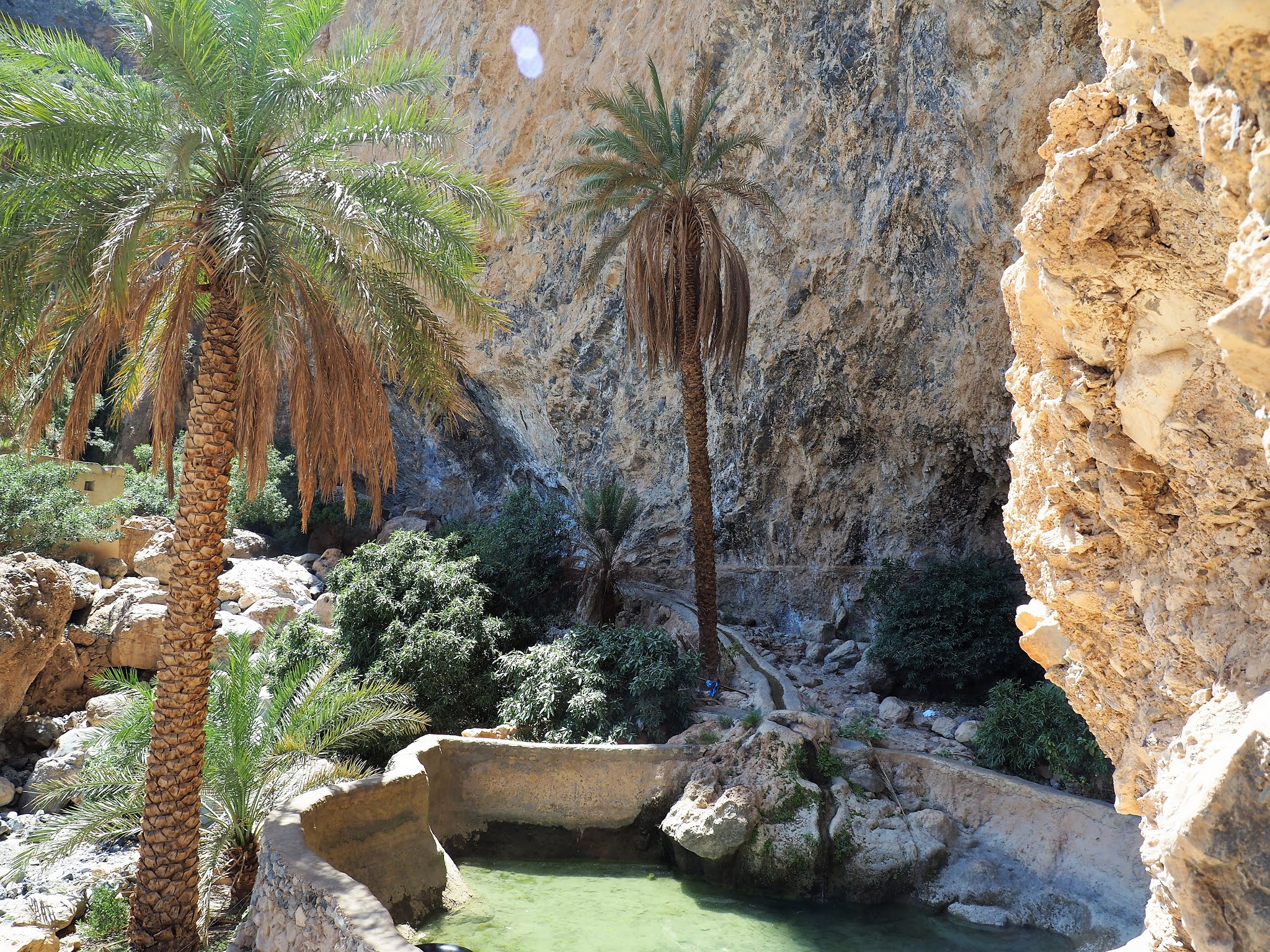
Below the village there is a small oases and clean drinking water is running down the rocks. Yes we drunk and no we did not get sick :). The big pool is also typical for these villages - this is where villagers used to wash and bath, it was very a regular meeting point in the past.
Can you see the people in the middle? Those are the local man with kids who we followed for some time. When they returned (I counted all kids were there) he asked what happened, where did we go - we said the climb was too difficult for us. He was not impressed while he looked down on our feet :) - we were wearing hiking shoes, they did it in the traditional white robes and in slippers :).
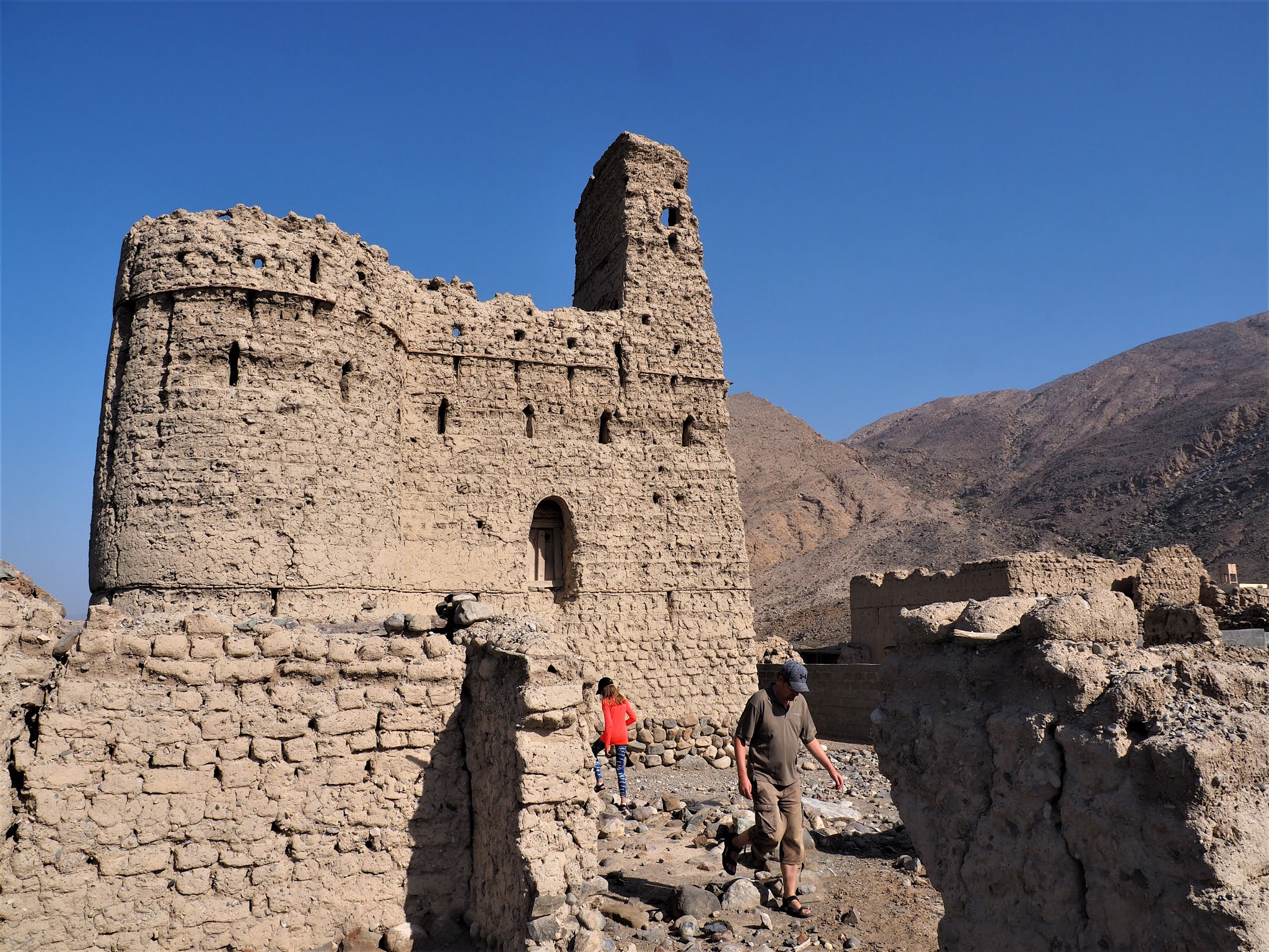
On the way home as we said good bye to Wadi Sahtan we stopped at Tabaqa castle - an other mud brick and stone ruin. It is not preserved at all but still maintains some of the old glory. Location: 23.3888,57.3142


Comments
Post a Comment